Road gullies (private roads) – cleaning schedules that prevent flooding
What is a drainage plan?
When it comes to understanding how your property drains, nothing beats a clear drainage plan.
It's your map of what lies underground, showing where every pipe, manhole, and connection runs.
For homeowners, builders, and buyers, that knowledge can prevent costly mistakes.
At ASL Limited, we create professional drainage plans from live CCTV surveys and years of on-site experience, so you can make informed decisions before digging, building, or buying.
What does a drainage plan show?
A drainage plan is a detailed map of your property's underground drainage system.
It typically shows:
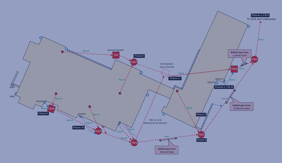
- Foul drains (waste from toilets, sinks, baths, etc.)
- Surface water drains (rainwater from roofs, drives, and gullies)
- Manholes, soakaways, and inspection chambers
- Flow direction and pipe materials
- Connections to public sewers or private treatment systems
Every property is different, especially older ones, so a modern drainage plan gives you a record of what's really there.
When you might need one.
| Situation | Why It Helps |
|---|---|
| Buying a property | Confirms the system is working, mapped, and compliant |
| Building an extension or outbuilding | Avoids hitting or covering existing drains |
| Replacing a septic tank or treatment plant | Shows where foul and surface water systems divide |
| Connecting to the mains | Required by local authorities before approval |
| Persistent drain issues | Helps trace recurring blockages or misconnections |
What you get when you order a drainage plan from ASL Limited.
Every ASL Limited drainage plan includes:
- ✅ On-site CCTV mapping survey by trained engineers
- ✅ Schematic diagram of all accessible underground drainage
- ✅ Flow direction arrows and system labels
- ✅ Photos and video footage (on request)
- ✅ Digital copies for your records or builder
- ✅ Professional interpretation and recommendations
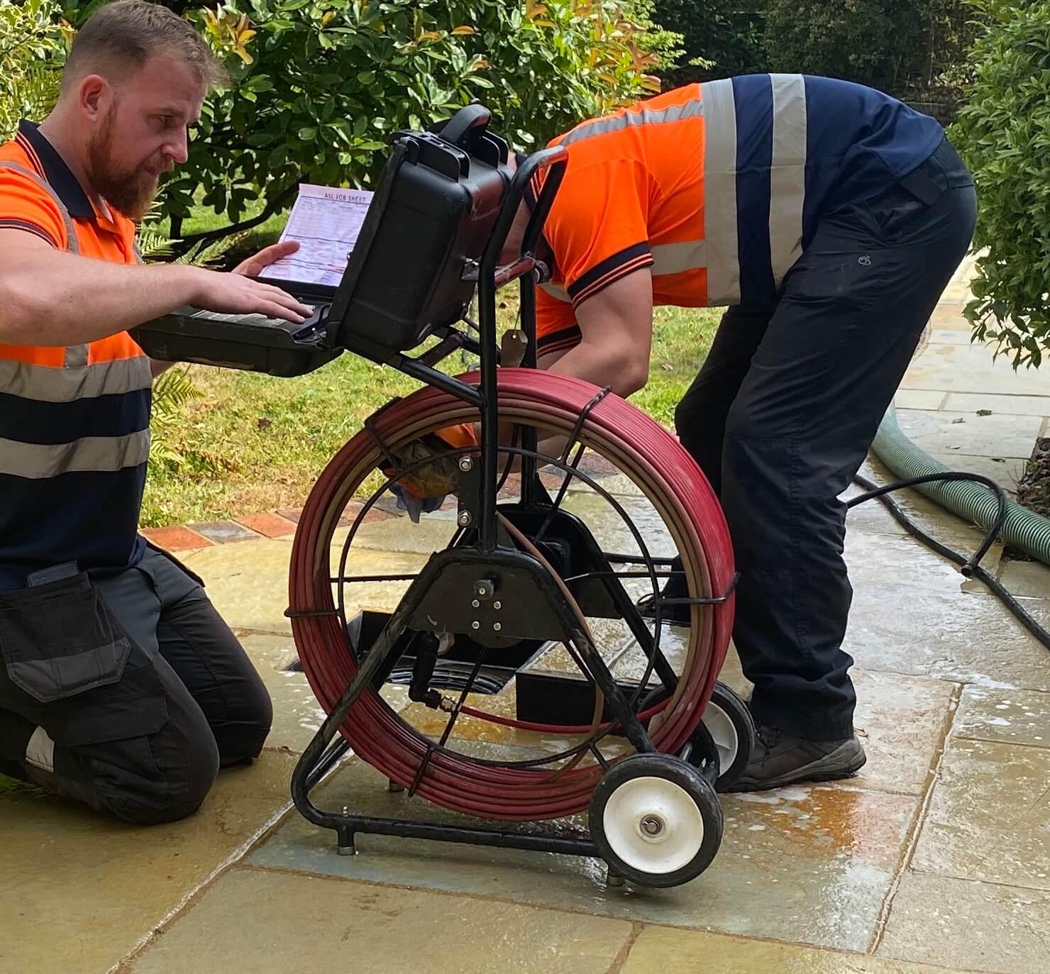
Why a CCTV mapping survey matters.
We don't guess where your drains are. We prove it.
Our mapping surveys use high-resolution cameras and electronic sonde tracing to pinpoint the exact route and depth of every pipe.
This means your plan isn't just a drawing, it's evidence.
That's especially useful for homebuyers, architects, or builders needing to show accurate drainage information to local authorities or water companies.
Need a drainage plan for your house?
Whether you're buying, building, or simply unsure what's under your garden:
📞 Call ASL Limited on 0800 181 684 or get in touch via our contact form.
We'll show you exactly what's underground, so you can plan above it with confidence.
We cover Surrey, Berkshire, Hampshire, West Sussex and South West London.
Related services.
To learn more about how ASL Limited can help you understand and protect your property's drainage: